You can combine this tour with every other tour here in Bahia
Not only with my " Salvador, 500 years in 1 day " cultural tour but also with a visit of Cachoeira for example. What often is required is a direct link to Morro de São Paulo via the ferryboat of Valença, a trip I do regularly so you can easily gain 6 hours of extra traveling as I take a shotcut inlands (instead of traveling back to Salvador first). Layout your wishes and I will make you a perfect travel plan.
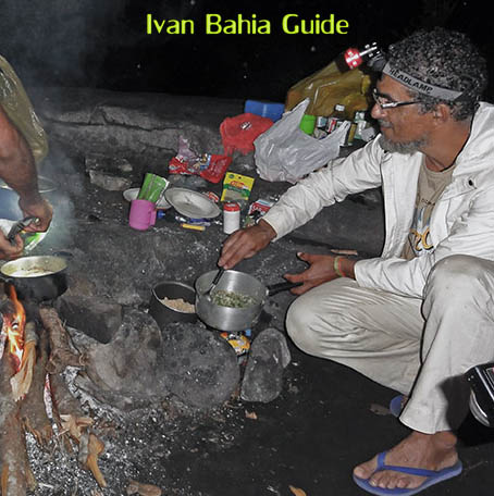
We do trekkings with our local specialist Trajano all through the park from East to West in 3 days
Also in Chapada Diamantina we will bring you in close contact with local people, It is interesting to learn about local habits, we will make sure you meet the locals in person and discover how friendly the people in the National Park are, like our local Trekking Specialist Trajano who is preparing diner on a woodfire on the picture above.
We offer exclusive PRIVATE TRANSFER from Lençois (Chapada Diamantina) DIRECTLY to Valença where you can take the ferryboat to the islands MORRO DE SAO PAULO and/or BOIPEBA. This allows you to win a day's travel time.


